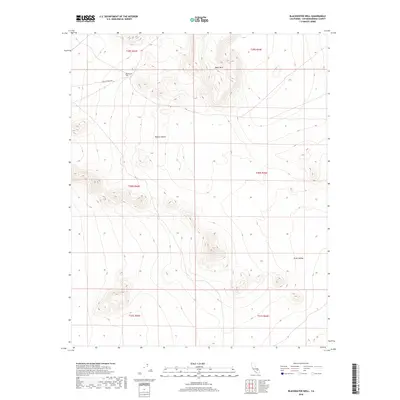
2018 Map of Blackwater Well
USGS Topo · Published 2018About this map
The high desert landscape of San Bernardino County is documented in this 2018 survey, centered on the historic Blackwater Well site within the Mojave Desert. This remote interior region is characterized by significant topographical relief, most notably the Black Hills rising in the northern portion of the map and the broad expanse of Grass Valley to the southeast. Human infrastructure is minimal in this arid environment, represented primarily by the unpaved corridor of Granit Wells Rd, which provides access through the rugged terrain. The map meticulously records the Public Land Survey System grid, including townships t29s r43e and t30s r44e, serving as a precise modern reference for land boundaries and geographic features in this corner of the California desert.
Find a feature on this map
11 named features on this map. Tap any name to fly to it.
Don’t see what you’re looking for? This feature index may not catch every label — zoom into the map to look around manually.
Map Details
Editions of this 2018 Blackwater Well Map
This is the sole edition of this map. No revisions or reprints were ever made.
Other maps of this area

1915 · Searles Lake
USGS Topo · 1:250,000

1947 · Trona
USGS Topo · 1:250,000

1948 · Trona
USGS Topo · 1:250,000

1953 · Trona
USGS Topo · 1:250,000

1954 · Pilot Knob
USGS Topo · 1:62,500

1954 · Cuddeback Lake
USGS Topo · 1:62,500

1955 · Opal Mountain
USGS Topo · 1:62,500

1956 · Fremont Peak
USGS Topo · 1:62,500

1957 · Trona
USGS Topo · 1:250,000

1960 · Trona
USGS Topo · 1:250,000