
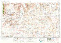
1957 Map of Trona
USGS Topo · Published 1964About this map
Searles Lake and the industrial potash settlements that grew around its saline crust anchor the northern portion of this High Desert landscape. By the late 1950s, the region was defined by a mix of specialized mining towns like Trona, Borosolvay, and Argus, alongside the massive footprint of the Naval Ordnance Test Station. Further south, the historic mining district surrounding Randsburg and Johannesburg remains prominent, connected to the wider world by the Southern Pacific RR.
Find a feature on this map
85 named features on this map. Tap any name to fly to it.
Don’t see what you’re looking for? This feature index may not catch every label — zoom into the map to look around manually.
Map Details
Editions of this 1957 Trona Map
5 editions found
Other maps of this area

1903 · Randsburg
USGS Topo · 1:62,500

1905 · Olancha
USGS Topo · 1:125,000

1906 · Kernville
USGS Topo · 1:125,000

1907 · Olancha
USGS Topo · 1:125,000

1907 · Las Vegas
USGS Topo · 1:250,000

1908 · Furnace Creek
USGS Topo · 1:250,000

1908 · Las Vegas
USGS Topo · 1:250,000

1908 · Kernville
USGS Topo · 1:125,000

1908 · Ballarat
USGS Topo · 1:250,000

1910 · Furnace Creek
USGS Topo · 1:250,000