
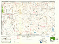
1960 Map of Trona
USGS Topo · Published 1960About this map
Industrial mineral extraction and military training dominate this high-desert landscape, centered on the dry basins of Searles Lake and China Lake. In the mid-century, the settlement of Trona serves as a hub for the Soda Works, while the mining traditions of the Rand Mountains are evidenced by the nearby town of Randsburg. To the east, the extensive Camp Irwin Military Reservation covers a vast portion of the Mojave, characterized by remote landmarks like Bicycle Lake and Leach Lake.
Find a feature on this map
120 named features on this map. Tap any name to fly to it.
Don’t see what you’re looking for? This feature index may not catch every label — zoom into the map to look around manually.
Map Details
Editions of this 1960 Trona Map
2 editions found
Other maps of this area

1903 · Randsburg
USGS Topo · 1:62,500

1905 · Olancha
USGS Topo · 1:125,000

1906 · Kernville
USGS Topo · 1:125,000

1907 · Olancha
USGS Topo · 1:125,000

1907 · Las Vegas
USGS Topo · 1:250,000

1908 · Furnace Creek
USGS Topo · 1:250,000

1908 · Las Vegas
USGS Topo · 1:250,000

1908 · Kernville
USGS Topo · 1:125,000

1908 · Ballarat
USGS Topo · 1:250,000

1910 · Furnace Creek
USGS Topo · 1:250,000