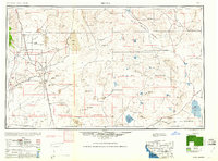
1960 Map of Trona
USGS Topo · Published 1960About this map
Industrial operations around Searles Lake anchor this mid-century view of the high desert, where the company town of Trona and the nearby Westend serve as centers for mineral extraction. The vast landscape transitions from the residential hubs of Ridgecrest and Inyokern in the west to the southern reaches of Death Valley National Monument in the north. This survey documents a critical period of desert utility, showing the extensive Camp Irwin Military Reservation and the complex network of spring-fed outposts like Saratoga Spring and Bitter Spring.
Find a feature on this map
104 named features on this map. Tap any name to fly to it.
Don’t see what you’re looking for? This feature index may not catch every label — zoom into the map to look around manually.
Map Details
Editions of this 1960 Trona Map
2 editions found

Other maps of this area

1903 · Randsburg
USGS Topo · 1:62,500

1905 · Olancha
USGS Topo · 1:125,000

1906 · Kernville
USGS Topo · 1:125,000

1907 · Olancha
USGS Topo · 1:125,000

1907 · Las Vegas
USGS Topo · 1:250,000

1908 · Furnace Creek
USGS Topo · 1:250,000

1908 · Las Vegas
USGS Topo · 1:250,000

1908 · Kernville
USGS Topo · 1:125,000

1908 · Ballarat
USGS Topo · 1:250,000

1910 · Furnace Creek
USGS Topo · 1:250,000