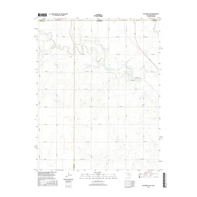
2016 Map of Blackwell NW
USGS Topo · Published 2016About this map
Bluff Creek meanders across the Kansas-Oklahoma state line, anchoring a rural landscape defined by the intersection of Sumner, Grant, and Kay counties. This agricultural borderland is marked by a precise grid of country roads, including W Judo Rd and W Earth Rd, which navigate the drainages of Doe Cr and Sand Cr. The presence of the Triumph Cem in the eastern portion of the survey provides a significant anchor for genealogical research, situated south of W Bender Rd. Along the winding path of the creek, Lake Blackwell appears as a notable water feature, flanked by Northside Rd and Southside Rd. The map illustrates the persistent 19th-century township-and-range surveying system as it transitions between the two states, showing how early territorial boundaries still dictate the placement of modern infrastructure and rural property lines.
Find a feature on this map
42 named features on this map. Tap any name to fly to it.
Don’t see what you’re looking for? This feature index may not catch every label — zoom into the map to look around manually.
Map Details
Editions of this 2016 Blackwell NW Map
This is the sole edition of this map. No revisions or reprints were ever made.
Other maps of this area

1889 · Caldwell
USGS Topo · 1:125,000

1890 · Wellington
USGS Topo · 1:125,000

1893 · Caldwell
USGS Topo · 1:125,000

1897 · Caldwell
USGS Topo · 1:125,000

1955 · Wichita
USGS Topo · 1:250,000

1955 · Enid
USGS Topo · 1:250,000

1958 · Enid
USGS Topo · 1:250,000

1958 · Wichita
USGS Topo · 1:250,000

1965 · Portland
USGS Topo · 1:24,000

1965 · South Haven
USGS Topo · 1:24,000