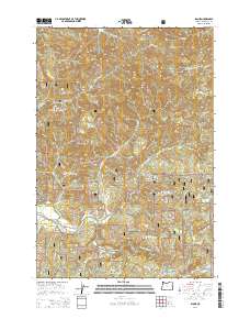
2014 Map of Blaine
USGS Topo · Published 2014About this map
The settlement of Blaine occupies a narrow valley in the coastal mountains, serving as a focal point for this 2014 survey of the Siuslaw National Forest. The landscape is defined by the steep, timbered ridges that separate the Nestucca River from the headwaters of the S Fork Trask River. This area is characterized by heavy forest management and remote peaks like Hardscrabble Mtn and Grindstone Mtn. The Blaine Cem stands as a local genealogical landmark near the river, while an extensive network of forest roads, including Upper Nestucca Rd and Blaine Rd, provides access through the rugged terrain of t3s r8w and surrounding townships. The intricate drainage patterns of Moon Cr, East Cr, and Fawcett Cr illustrate the complex hydrology typical of the Oregon Coast Range, where deep canyons and high points like High Peak dictate the path of early travel routes.
Find a feature on this map
44 named features on this map. Tap any name to fly to it.
Don’t see what you’re looking for? This feature index may not catch every label — zoom into the map to look around manually.
Map Details
Editions of this 2014 Blaine Map
This is the sole edition of this map. No revisions or reprints were ever made.
Other maps of this area

1941 · Nestucca Bay
USGS Topo · 1:62,500

1942 · Ginger Peak
USGS Topo · 1:62,500

1942 · Spirit Mtn
USGS Topo · 1:62,500

1942 · Nestucca Bay
USGS Topo · 1:62,500

1942 · Tillamook
USGS Topo · 1:62,500

1948 · Vancouver
USGS Topo · 1:250,000

1950 · Vancouver
USGS Topo · 1:250,000

1950 · Vancouver
USGS Topo · 1:250,000

1955 · Hebo
USGS Topo · 1:62,500

1955 · Blaine
USGS Topo · 1:62,500