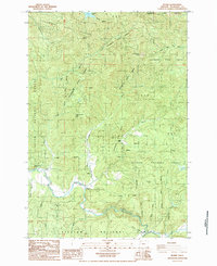
1984 Map of Blaine
USGS Topo · Published 1984About this map
The Nestucca River winds through the heart of this coastal mountain landscape, where the small settlement of Blaine serves as a primary point of reference. This mid-1980s survey illustrates a region defined by managed timberlands, split between the Tillamook State Forest and the Siuslaw National Forest. The presence of Detrick Ranch and a Quarry suggests the local reliance on agricultural and extractive land use amidst the steep drainage basins of Fawcett Creek and Beaver Creek. High points such as Hardscrabble Mtn, Grindstone Mtn, and Camelback Bluff dominate the topography, providing a detailed look at the watershed divides that separate the Trask and Nestucca systems. For genealogists and local historians, the map records the specific placement of rural residences and named peaks like Square Top and High Peak during the late twentieth century.
Find a feature on this map
35 named features on this map. Tap any name to fly to it.
Don’t see what you’re looking for? This feature index may not catch every label — zoom into the map to look around manually.
Map Details
Editions of this 1984 Blaine Map
This is the sole edition of this map. No revisions or reprints were ever made.
Other maps of this area

1941 · Nestucca Bay
USGS Topo · 1:62,500

1942 · Ginger Peak
USGS Topo · 1:62,500

1942 · Spirit Mtn
USGS Topo · 1:62,500

1942 · Nestucca Bay
USGS Topo · 1:62,500

1942 · Tillamook
USGS Topo · 1:62,500

1948 · Vancouver
USGS Topo · 1:250,000

1950 · Vancouver
USGS Topo · 1:250,000

1950 · Vancouver
USGS Topo · 1:250,000

1955 · Hebo
USGS Topo · 1:62,500

1955 · Blaine
USGS Topo · 1:62,500