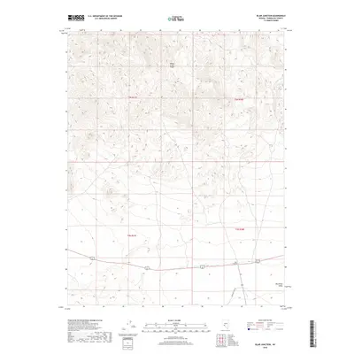
2018 Map of Blair Junction
USGS Topo · Published 2018About this map
Monte Cristo Range dominates the northern half of this landscape, its complex contours marking the high ground above the expansive Big Smoky Valley to the south. This transition point in Esmeralda County is centered on Blair Junction, where travel routes converge in the desert floor. The map highlights the intersection of modern transportation and older paths, including Emigrant Pass Rd, which cuts through the southern reaches of the quadrangle. The township and range lines of t3n r37e and t2n r38e provide a clear grid for locating specific parcels of land within this arid interior basin, showing a terrain shaped by wide alluvial fans and ancient drainage patterns typical of the Great Basin region.
Find a feature on this map
8 named features on this map. Tap any name to fly to it.
Don’t see what you’re looking for? This feature index may not catch every label — zoom into the map to look around manually.
Map Details
Editions of this 2018 Blair Junction Map
This is the sole edition of this map. No revisions or reprints were ever made.
Other maps of this area

1898 · Silver Peak
USGS Topo · 1:125,000

1900 · Silver Peak
USGS Topo · 1:125,000

1907 · Tonopah
USGS Topo · 1:250,000

1908 · Lida
USGS Topo · 1:250,000

1908 · Tonopah
USGS Topo · 1:250,000

1913 · Lida
USGS Topo · 1:250,000

1954 · Goldfield
USGS Topo · 1:250,000

1955 · Goldfield
USGS Topo · 1:250,000

1956 · Tonopah
USGS Topo · 1:250,000

1958 · Goldfield
USGS Topo · 1:250,000