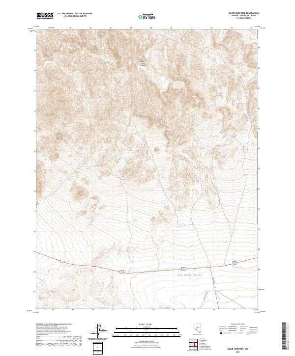
2021 Map of Blair Junction
USGS Topo · Published 2021About this map
Monte Cristo Range dominates the northern half of this Nevada landscape, where steep slopes descend into the broad expanse of Big Smoky Valley to the south. This transition from high terrain to valley floor is a classic representation of the Great Basin's basin-and-range topography. Modern transportation corridors, including the combined route of 6 95 and 265, navigate the base of these elevations. Historical transit is evidenced by Emigrant Pass Rd and Nivloc Rd, which strike out toward local mining districts and neighboring valleys. The map provides a clear record of the public land survey system divisions, including t3n r37e and t2n r38e, defining the cadastral framework of this corner of Esmeralda County.
Find a feature on this map
10 named features on this map. Tap any name to fly to it.
Don’t see what you’re looking for? This feature index may not catch every label — zoom into the map to look around manually.
Map Details
Editions of this 2021 Blair Junction Map
This is the sole edition of this map. No revisions or reprints were ever made.
Other maps of this area

1898 · Silver Peak
USGS Topo · 1:125,000

1900 · Silver Peak
USGS Topo · 1:125,000

1907 · Tonopah
USGS Topo · 1:250,000

1908 · Lida
USGS Topo · 1:250,000

1908 · Tonopah
USGS Topo · 1:250,000

1913 · Lida
USGS Topo · 1:250,000

1954 · Goldfield
USGS Topo · 1:250,000

1955 · Goldfield
USGS Topo · 1:250,000

1956 · Tonopah
USGS Topo · 1:250,000

1958 · Goldfield
USGS Topo · 1:250,000