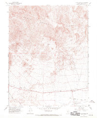
1968 Map of Blair Junction
USGS Topo · Published 1970About this map
Blair Junction serves as the primary focal point in this high-desert landscape, situated where the northern edge of the Big Smoky Valley meets the rugged slopes of the Monte Cristo Range. The map documents a transition in regional infrastructure during the late 1960s, showing the path of an Old Railroad Grade and a significant Aqueduct cutting across the valley floor. Evidence of mineral exploration and industrial activity is scattered throughout the terrain, marked by various prospects and a Gravel Pit. Notable landmarks for navigation and utility in this arid environment include a Radio Facility, a Dry Well, and a natural Seep tucked into the mountain folds. The survey effectively illustrates the sparse settlement patterns of Esmeralda County, where transportation corridors and isolated mining sites define the human footprint.
Find a feature on this map
11 named features on this map. Tap any name to fly to it.
Don’t see what you’re looking for? This feature index may not catch every label — zoom into the map to look around manually.
Map Details
Editions of this 1968 Blair Junction Map
This is the sole edition of this map. No revisions or reprints were ever made.
Other maps of this area

1898 · Silver Peak
USGS Topo · 1:125,000

1900 · Silver Peak
USGS Topo · 1:125,000

1907 · Tonopah
USGS Topo · 1:250,000

1908 · Lida
USGS Topo · 1:250,000

1908 · Tonopah
USGS Topo · 1:250,000

1913 · Lida
USGS Topo · 1:250,000

1954 · Goldfield
USGS Topo · 1:250,000

1955 · Goldfield
USGS Topo · 1:250,000

1956 · Tonopah
USGS Topo · 1:250,000

1958 · Goldfield
USGS Topo · 1:250,000