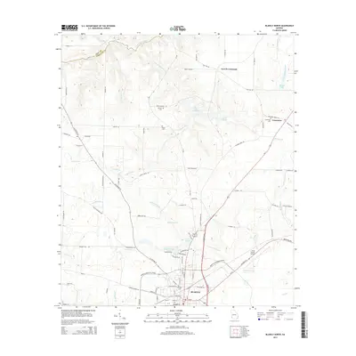
2014 Map of Blakely North
USGS Topo · Published 2014About this map
Blakely serves as the focal point of this Early County landscape, where the street grid of the town center transitions into a network of rural roads and watercourses. The northern outskirts are defined by a series of small lakes and creek systems, including Lake Kolomoki, Lake Yohola, and Singletary Lake, which collect drainage from the surrounding agricultural lands. Cultural landmarks are scattered throughout the region, ranging from the ancient Indian Mounds near Mercier Cemetery to the more modern infrastructure of the Early County Airport. The map documents a blend of family history and geographic detail, preserved through named cemeteries like Mt Hope Cemetery and Hayes Cemetery. Significant transportation corridors such as GA Highway 39 and the Martin Luther King Jr Boulevard bypass connect the community to outlying settlements like Colomokee and Ferrell Crossroads.
Find a feature on this map
95 named features on this map. Tap any name to fly to it.
Don’t see what you’re looking for? This feature index may not catch every label — zoom into the map to look around manually.
Map Details
Editions of this 2014 Blakely North Map
This is the sole edition of this map. No revisions or reprints were ever made.
Other maps of this area

1953 · Dothan
USGS Topo · 1:250,000

1954 · Dothan
USGS Topo · 1:250,000

1955 · Dothan
USGS Topo · 1:250,000

1969 · Fort Gaines
USGS Topo · 1:24,000

1970 · Columbia NE
USGS Topo · 1:24,000

1970 · Columbia
USGS Topo · 1:24,000

1973 · Blakely North
USGS Topo · 1:24,000

1973 · Bancroft
USGS Topo · 1:24,000

1973 · Blakely South
USGS Topo · 1:24,000
1973 · Bluffton
USGS Topo · 1:24,000