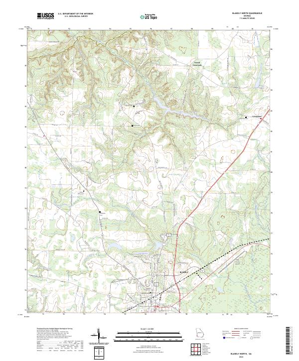
2024 Map of Blakely North
USGS Topo · Published 2024About this map
Blakely serves as the focal point of this Southwest Georgia landscape, where the Early County Courthouse anchors the town center. The surrounding rural terrain is defined by a network of creeks and branches that feed into the local watershed, including Kolomoki Creek and its southern counterpart, Little Kolomoki Creek. These waterways dictate the historical development of the area, as seen in the placement of small agricultural settlements like Colomokee and Ferrell Crossroads.
Find a feature on this map
88 named features on this map. Tap any name to fly to it.
Don’t see what you’re looking for? This feature index may not catch every label — zoom into the map to look around manually.
Map Details
Editions of this 2024 Blakely North Map
This is the sole edition of this map. No revisions or reprints were ever made.
Other maps of this area

1953 · Dothan
USGS Topo · 1:250,000

1954 · Dothan
USGS Topo · 1:250,000

1955 · Dothan
USGS Topo · 1:250,000

1969 · Fort Gaines
USGS Topo · 1:24,000

1970 · Columbia NE
USGS Topo · 1:24,000

1970 · Columbia
USGS Topo · 1:24,000

1973 · Blakely North
USGS Topo · 1:24,000

1973 · Bancroft
USGS Topo · 1:24,000

1973 · Blakely South
USGS Topo · 1:24,000
1973 · Bluffton
USGS Topo · 1:24,000