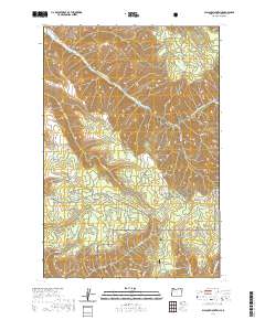
2020 Map of Blalock Mountain
USGS Topo · Published 2020About this map
Umatilla National Forest encompasses the high ridges and deep drainage systems of this portion of Umatilla County. The landscape is defined by the steep descent toward the S Fork Walla Walla River in the north and the complex network of mountain summits including Blalock Mtn, Weston Mtn, and Reed and Hawley Mtn. Water resources are a prominent feature of the terrain, from the Stone Hill Reservoir and Weston Pond to numerous named springs like Cold Spring and Dick Spring. The map documents a network of high-elevation access routes, including Lincton Mountain Rd and the Sf Walla Walla Trail, which trace the difficult topography of Tamarack Basin and Flume Canyon. This layout reflects a managed wilderness where early land use is marked by named summits and the vital movement of water through rugged gulches.
Find a feature on this map
45 named features on this map. Tap any name to fly to it.
Don’t see what you’re looking for? This feature index may not catch every label — zoom into the map to look around manually.
Map Details
Editions of this 2020 Blalock Mountain Map
This is the sole edition of this map. No revisions or reprints were ever made.
Other maps of this area

1953 · Pendleton
USGS Topo · 1:250,000

1956 · Pendleton
USGS Topo · 1:250,000

1963 · Big Meadows
USGS Topo · 1:24,000

1963 · Andies Prairie
USGS Topo · 1:24,000

1963 · Bingham Springs
USGS Topo · 1:24,000

1963 · Tollgate
USGS Topo · 1:24,000

1963 · Blalock Mountain
USGS Topo · 1:24,000

1963 · Peterson Ridge
USGS Topo · 1:24,000

1964 · Bowlus Hill
USGS Topo · 1:24,000

1964 · Weston Mountain
USGS Topo · 1:24,000