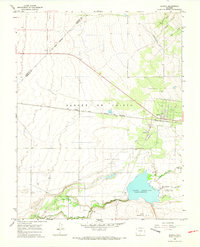
1965 Map of Blanca
USGS Topo · Published 1968About this map
The town of Blanca serves as the focal point of this high-altitude landscape, situated along the Denver and Rio Grande Western railroad line. The mid-1960s terrain is defined by its complex water management system, where the Garland Ditch and several creeks, including Blanca Creek, flow toward the expansive Smith Reservoir. To the south, the Basaltic Hills rise above the winding path of Trinchera Creek, while the Sangre de Cristo Creek meanders through the central valley.
Find a feature on this map
20 named features on this map. Tap any name to fly to it.
Don’t see what you’re looking for? This feature index may not catch every label — zoom into the map to look around manually.
Map Details
Editions of this 1965 Blanca Map
3 editions found
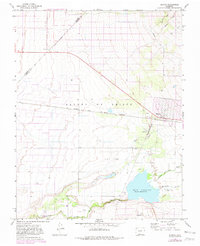
Other maps of this area

1889 · Huerfano Park
USGS Topo · 1:125,000

1892 · Huerfano Park
USGS Topo · 1:125,000

1954 · Trinidad
USGS Topo · 1:250,000

1955 · Trinidad
USGS Topo · 1:250,000

1958 · Trinidad
USGS Topo · 1:250,000

1959 · Trinidad
USGS Topo · 1:250,000

1965 · Blanca
USGS Topo · 1:24,000

1965 · Baldy
USGS Topo · 1:24,000

1965 · Lasauses
USGS Topo · 1:24,000

1965 · Blanca SE
USGS Topo · 1:24,000