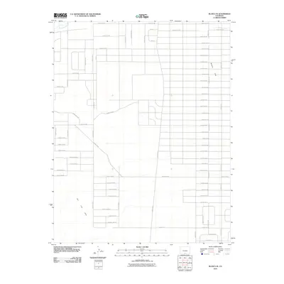
2010 Map of Blanca SE
USGS Topo · Published 2010About this map
Trinchera Creek winds through the northwestern corner of this high-altitude landscape, feeding into a grid-iron network of irrigation and infrastructure. The area is defined by its agricultural layout, where the Trinchera Canal and a dense system of county roads, such as County Rd-108 and Arapaho Ave, organize the terrain into a sprawling patchwork of potential farmland. To the south and east, the natural topography breaks the man-made grid as the San Luis Hills and the Basaltic Hills rise from the valley floor. This intersection of systematic land division and volcanic geology reflects the late 20th-century development of water rights and rural access in the San Luis Valley. The map captures the specialized road numbering system, including corridors like County Rd-100 and named thoroughfares like Navajo Ave, which facilitate movement between the hills and the cultivated basins.
Find a feature on this map
71 named features on this map. Tap any name to fly to it.
Don’t see what you’re looking for? This feature index may not catch every label — zoom into the map to look around manually.
Map Details
Editions of this 2010 Blanca SE Map
This is the sole edition of this map. No revisions or reprints were ever made.
Other maps of this area

1954 · Trinidad
USGS Topo · 1:250,000

1955 · Trinidad
USGS Topo · 1:250,000

1958 · Trinidad
USGS Topo · 1:250,000

1959 · Trinidad
USGS Topo · 1:250,000

1965 · Blanca
USGS Topo · 1:24,000

1965 · Baldy
USGS Topo · 1:24,000

1965 · Lasauses
USGS Topo · 1:24,000

1965 · Blanca SE
USGS Topo · 1:24,000

1967 · San Luis
USGS Topo · 1:24,000

1967 · Fort Garland SW
USGS Topo · 1:24,000