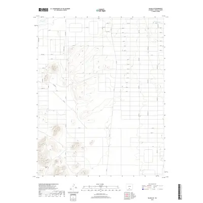
2019 Map of Blanca SE
USGS Topo · Published 2019About this map
San Luis Hills dominate the southwestern corner of this Costilla County landscape, providing a stark topographical contrast to the surrounding high-desert plains. This 2019 survey documents a meticulous grid of rural access roads, including Rio Grand, which suggest planned land divisions or settlement patterns in the valley. The presence of water infrastructure like the Trinchera Canal in the northeast and Frinchera Cr in the northwest highlights the essential role of irrigation in this arid region. The map captures a transitional landscape where natural landforms meet a highly structured human geometry of numbered streets and avenues, ranging from 5th Street to 33rd St.
Find a feature on this map
46 named features on this map. Tap any name to fly to it.
Don’t see what you’re looking for? This feature index may not catch every label — zoom into the map to look around manually.
Map Details
Editions of this 2019 Blanca SE Map
This is the sole edition of this map. No revisions or reprints were ever made.
Other maps of this area

1954 · Trinidad
USGS Topo · 1:250,000

1955 · Trinidad
USGS Topo · 1:250,000

1958 · Trinidad
USGS Topo · 1:250,000

1959 · Trinidad
USGS Topo · 1:250,000

1965 · Blanca
USGS Topo · 1:24,000

1965 · Baldy
USGS Topo · 1:24,000

1965 · Lasauses
USGS Topo · 1:24,000

1965 · Blanca SE
USGS Topo · 1:24,000

1967 · San Luis
USGS Topo · 1:24,000

1967 · Fort Garland SW
USGS Topo · 1:24,000