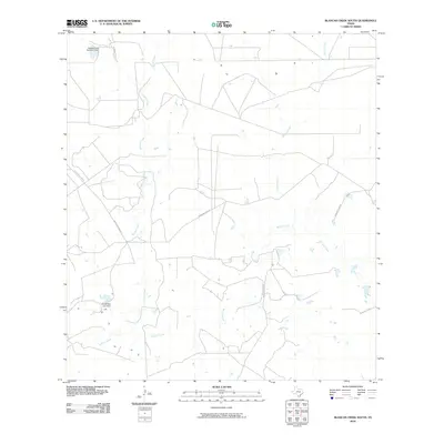
2010 Map of Blancas Creek South
USGS Topo · Published 2010About this map
Dolores Creek and Blancas Creek define the arid drainage patterns of this South Texas landscape in Webb County. The presence of irrigation and water management structures like the Hubbard Lake Number 2 Dam and the Carlos Vela Lake Dam indicates the vital importance of water storage for ranching and agriculture in this semi-arid region. Most transportation is facilitated by the prominent Mangana-Hein Rd, which threads across the terrain, connecting various rural access points. The map also captures the path of El Jaral Creek, showing a network of ephemeral waterways that characterize the brush country environment during the early 21st century.
Find a feature on this map
6 named features on this map. Tap any name to fly to it.
Don’t see what you’re looking for? This feature index may not catch every label — zoom into the map to look around manually.
Map Details
Editions of this 2010 Blancas Creek South Map
This is the sole edition of this map. No revisions or reprints were ever made.
Other maps of this area

1933 · Becerra Creek
USGS Topo · 1:62,500

1940 · Aguilares
USGS Topo · 1:62,500

1940 · Mogotes Hill
USGS Topo · 1:62,500

1942 · San Ygnacio
USGS Topo · 1:62,500

1956 · Mogotes Hill
USGS Topo · 1:62,500

1956 · Laredo
USGS Topo · 1:250,000

1979 · Laredo South
USGS Topo · 1:24,000

1979 · O'Keefe Lake
USGS Topo · 1:24,000

1980 · Blancas Creek North
USGS Topo · 1:24,000
1980 · Agua Azul Creek West
USGS Topo · 1:24,000