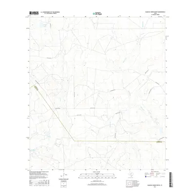
2016 Map of Blancas Creek South
USGS Topo · Published 2016About this map
Blancas Creek and its southern tributaries wind through the arid South Texas brush country along the border of Webb and Zapata counties. The landscape is defined by ranching infrastructure and intermittent water sources, characterized by a series of named cattle tanks and small reservoirs such as Carlos Vela Lake, Hubbard Lake Number 2, and La Perla Ranch Lake Number 1. These water features are essential landmarks in a region where drainage ways like Dolores Cr and El Jaral Cr carve subtle relief into the terrain.
Find a feature on this map
13 named features on this map. Tap any name to fly to it.
Don’t see what you’re looking for? This feature index may not catch every label — zoom into the map to look around manually.
Map Details
Editions of this 2016 Blancas Creek South Map
This is the sole edition of this map. No revisions or reprints were ever made.
Other maps of this area

1933 · Becerra Creek
USGS Topo · 1:62,500

1940 · Aguilares
USGS Topo · 1:62,500

1940 · Mogotes Hill
USGS Topo · 1:62,500

1942 · San Ygnacio
USGS Topo · 1:62,500

1956 · Mogotes Hill
USGS Topo · 1:62,500

1956 · Laredo
USGS Topo · 1:250,000

1979 · Laredo South
USGS Topo · 1:24,000

1979 · O'Keefe Lake
USGS Topo · 1:24,000

1980 · Blancas Creek North
USGS Topo · 1:24,000
1980 · Agua Azul Creek West
USGS Topo · 1:24,000