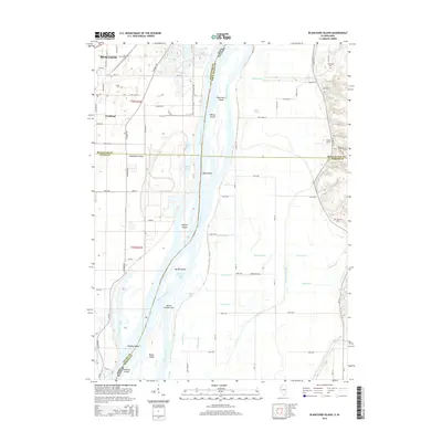
2015 Map of Blanchard Island
USGS Topo · Published 2015About this map
Mississippi River floodplains define this landscape along the border of Iowa and Illinois, where the shifting waters have carved a complex network of islands and chutes. The settlement of Fruitland sits on the western edge of the quadrangle, bordering the expansive Muscatine Island. This region is characterized by an intricate drainage system including Frieden Ditch, Hampton Ditch, and Muscatine Slough, reflecting a history of land management for the fertile bottomlands. Genealogy researchers will find several notable local burial grounds, such as Reynolds Cem, Island Cem, and Glancy Cem, positioned on higher ground away from the river’s edge. Significant river features like Blanchard Island, Kilpeck Island, and Ramsey Island emphasize the river's historical role as both a boundary and a vital corridor for the region.
Find a feature on this map
92 named features on this map. Tap any name to fly to it.
Don’t see what you’re looking for? This feature index may not catch every label — zoom into the map to look around manually.
Map Details
Editions of this 2015 Blanchard Island Map
This is the sole edition of this map. No revisions or reprints were ever made.
Other maps of this area

1916 · Edgington
USGS Topo · 1:62,500

1935 · Keithsburg
USGS Topo · 1:48,000

1938 · Edgington
USGS Topo · 1:62,500

1941 · Keithsburg
USGS Topo · 1:62,500

1946 · Wapello
USGS Topo · 1:62,500

1948 · Muscatine
USGS Topo · 1:62,500

1949 · Wapello
USGS Topo · 1:62,500

1953 · Toolesboro
USGS Topo · 1:24,000

1953 · Blanchard Island
USGS Topo · 1:24,000
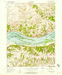
1953 · Illinois City
USGS Topo · 1:24,000