
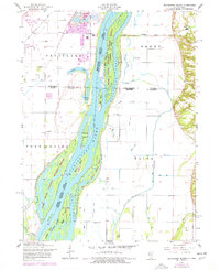
1953 Map of Blanchard Island
USGS Topo · Published 1958About this map
The Mississippi River dominates this mid-century landscape, acting as the shifting border between Iowa and Illinois. The river is a complex network of side channels and islands, including Blanchard Island and Kilpeck Island, which are protected within the Upper Mississippi River Wildlife and Fish Refuge. The map reveals a highly engineered riparian environment where natural features like Bogus Slough and Coleman Slough coexist with extensive human interventions such as Hampton Ditch and Main Ditch.
Find a feature on this map
51 named features on this map. Tap any name to fly to it.
Don’t see what you’re looking for? This feature index may not catch every label — zoom into the map to look around manually.
Map Details
Editions of this 1953 Blanchard Island Map
2 editions found
Other maps of this area

1916 · Edgington
USGS Topo · 1:62,500

1935 · Keithsburg
USGS Topo · 1:48,000

1938 · Edgington
USGS Topo · 1:62,500

1941 · Keithsburg
USGS Topo · 1:62,500

1946 · Wapello
USGS Topo · 1:62,500

1948 · Muscatine
USGS Topo · 1:62,500

1949 · Wapello
USGS Topo · 1:62,500

1953 · Toolesboro
USGS Topo · 1:24,000
1953 · Illinois City
USGS Topo · 1:24,000
1953 · Eliza
USGS Topo · 1:24,000