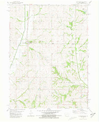
1981 Map of Blanchard
USGS Topo · Published 1981About this map
Blanchard straddles the state line in this early 1980s look at the borderlands of Page County, Iowa, and Atchison and Nodaway counties, Missouri. The settlement pattern here is deeply tied to the Norfolk and Western railroad, which runs parallel to the Tarkio River as it winds through Colfax and Lincoln townships. To the northeast, the village of College Springs sits near Grove Cem, serving as a secondary hub for this agrarian landscape.
Find a feature on this map
19 named features on this map. Tap any name to fly to it.
Don’t see what you’re looking for? This feature index may not catch every label — zoom into the map to look around manually.
Map Details
Editions of this 1981 Blanchard Map
This is the sole edition of this map. No revisions or reprints were ever made.
Other maps of this area

1939 · Tarkio
USGS Topo · 1:62,500

1939 · Farragut
USGS Topo · 1:62,500

1939 · Skidmore
USGS Topo · 1:62,500

1940 · Tarkio
USGS Topo · 1:62,500

1940 · Farragut
USGS Topo · 1:62,500

1940 · Coin
USGS Topo · 1:62,500

1941 · Tarkio
USGS Topo · 1:62,500

1941 · Skidmore
USGS Topo · 1:62,500

1942 · Skidmore
USGS Topo · 1:62,500

1943 · Coin
USGS Topo · 1:62,500