
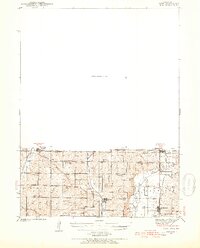
1940 Map of Coin
USGS Topo · Published 1954About this map
Blanchard and Braddyville sit directly along the border between Iowa and Missouri, highlighting the interconnected rural life of Page, Atchison, and Nodaway counties. The landscape is defined by the drainage patterns of the Nodaway River and the Tarkio River, which supported a dense network of farming communities during the mid-twentieth century. This era is characterized by an exceptional concentration of rural educational and spiritual centers, such as White Chapel Sch and Mt Tabor Sch, alongside early cemeteries like Union Grove Cem. Transportation is anchored by the Wabash and Chicago Burlington and Quincy railroads, which facilitated the movement of goods and people across the state line. The survey captures the region just before the consolidation of rural schools, preserving the names of small districts like Eureka Sch and Cottonwood Sch that were once central to local identity.
Find a feature on this map
38 named features on this map. Tap any name to fly to it.
Don’t see what you’re looking for? This feature index may not catch every label — zoom into the map to look around manually.
Map Details
Editions of this 1940 Coin Map
2 editions found
Other maps of this area

1939 · Tarkio
USGS Topo · 1:62,500

1939 · Farragut
USGS Topo · 1:62,500

1939 · Skidmore
USGS Topo · 1:62,500

1940 · Tarkio
USGS Topo · 1:62,500

1940 · Farragut
USGS Topo · 1:62,500

1940 · New Market
USGS Topo · 1:62,500

1941 · Tarkio
USGS Topo · 1:62,500

1941 · Skidmore
USGS Topo · 1:62,500

1942 · Skidmore
USGS Topo · 1:62,500

1943 · Coin
USGS Topo · 1:62,500