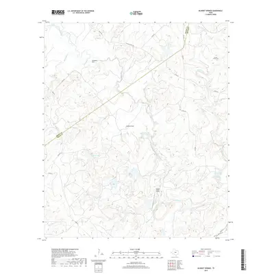
2019 Map of Blanket Springs
USGS Topo · Published 2019About this map
Pecan Bayou carves a winding path through the borderlands of Mills and Brown Counties, defining a landscape marked by ranching and water management. This area, north of Goldthwaite and west of Mullin, is characterized by the confluence of numerous tributaries including Panther Cr, Rough Cr, and Blanket Creek. Small-scale aviation and cemetery sites provide the primary markers of human settlement in this part of the Texas Hill Country. The presence of private aviation at the Vaughan Ranch Airport and the historic Blanket Springs Cem near the northeastern edge of the survey suggests a pattern of isolated ranching estates. Numerous named stock ponds and reservoirs, such as Williams Lake and the John Graves Lake Number 2, indicate the critical importance of water storage for livestock in this environment, where the terrain rises toward landmarks like Gobblers Knob.
Find a feature on this map
32 named features on this map. Tap any name to fly to it.
Don’t see what you’re looking for? This feature index may not catch every label — zoom into the map to look around manually.
Map Details
Editions of this 2019 Blanket Springs Map
This is the sole edition of this map. No revisions or reprints were ever made.
Other maps of this area

1885 · San Saba
USGS Topo · 1:125,000

1889 · Brownwood
USGS Topo · 1:125,000

1894 · Brownwood
USGS Topo · 1:125,000

1894 · San Saba
USGS Topo · 1:125,000

1925 · Brownwood 3-b
USGS Topo · 1:48,000

1925 · San Saba 2-a
USGS Topo · 1:48,000

1925 · Brownwood 3-d
USGS Topo · 1:48,000

1925 · San Saba 1-b
USGS Topo · 1:48,000

1925 · San Saba 2-b
USGS Topo · 1:48,000

1925 · Brownwood 4-c
USGS Topo · 1:48,000