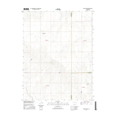
2016 Map of Bledsoe Ranch
USGS Topo · Published 2016About this map
Wareland sits at the heart of this high plains landscape, situated near the intersection of several county routes including Co RD 45. The area is defined by a series of drainage systems that carve through the terrain, most notably the seasonal flows of Sand Cr and Wild Horse Cr. The topography is marked by distinct geological depressions and water-cut features such as Folger Gulch and Aroya Gulch, which illustrate the natural erosion patterns of the Colorado prairie.
Find a feature on this map
21 named features on this map. Tap any name to fly to it.
Don’t see what you’re looking for? This feature index may not catch every label — zoom into the map to look around manually.
Map Details
Editions of this 2016 Bledsoe Ranch Map
This is the sole edition of this map. No revisions or reprints were ever made.
Other maps of this area

1891 · Arroyo
USGS Topo · 1:125,000

1893 · Arroyo
USGS Topo · 1:125,000

1954 · Limon
USGS Topo · 1:250,000

1954 · Lamar
USGS Topo · 1:250,000

1957 · Limon
USGS Topo · 1:250,000

1958 · Limon
USGS Topo · 1:250,000

1958 · Lamar
USGS Topo · 1:250,000

1978 · Sanders Ranch
USGS Topo · 1:24,000
1978 · Boyero
USGS Topo · 1:24,000

1978 · Clifford
USGS Topo · 1:24,000