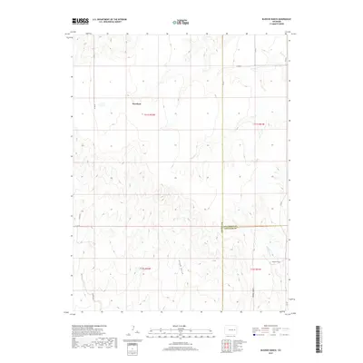
2019 Map of Bledsoe Ranch
USGS Topo · Published 2019About this map
Wareland and the eponymous Bledsoe Ranch anchor this landscape of the High Plains, where the borders of Lincoln, Kit Carson, and Cheyenne counties converge. The terrain is defined by a network of drainage systems including Sand Cr and Wild Horse Cr, alongside several significant depressions like Aroya Gulch, Adobe Gulch, and Folger Gulch. These features trace the natural hydrology of the region as it transitions between the township and range boundaries of t11s r52w and t12s r51w.
Find a feature on this map
20 named features on this map. Tap any name to fly to it.
Don’t see what you’re looking for? This feature index may not catch every label — zoom into the map to look around manually.
Map Details
Editions of this 2019 Bledsoe Ranch Map
This is the sole edition of this map. No revisions or reprints were ever made.
Other maps of this area

1891 · Arroyo
USGS Topo · 1:125,000

1893 · Arroyo
USGS Topo · 1:125,000

1954 · Limon
USGS Topo · 1:250,000

1954 · Lamar
USGS Topo · 1:250,000

1957 · Limon
USGS Topo · 1:250,000

1958 · Limon
USGS Topo · 1:250,000

1958 · Lamar
USGS Topo · 1:250,000

1978 · Sanders Ranch
USGS Topo · 1:24,000
1978 · Boyero
USGS Topo · 1:24,000

1978 · Clifford
USGS Topo · 1:24,000