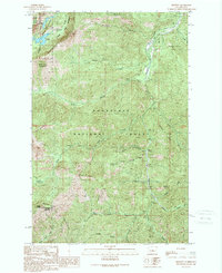
1989 Map of Blewett
USGS Topo · Published 1989About this map
The Stuart Range and the Wenatchee Mountains dominate this high-elevation terrain in the central Cascades, where steep ridges and deep drainages define the landscape. Centered near Blewett, the map illustrates a region managed for conservation and resource extraction, with the Alpine Lakes Wilderness protecting the northwest corner and the Wenatchee National Forest encompassing much of the remaining territory.
Find a feature on this map
33 named features on this map. Tap any name to fly to it.
Don’t see what you’re looking for? This feature index may not catch every label — zoom into the map to look around manually.
Map Details
Editions of this 1989 Blewett Map
2 editions found
Other maps of this area

1897 · Mount Stuart
USGS Topo · 1:125,000

1901 · Chiwaukum
USGS Topo · 1:125,000

1902 · Mount Stuart
USGS Topo · 1:125,000

1904 · Chiwaukum
USGS Topo · 1:125,000

1957 · Wenatchee
USGS Topo · 1:250,000

1961 · Liberty
USGS Topo · 1:62,500

1961 · Mount Stuart
USGS Topo · 1:62,500

1964 · Leavenworth
USGS Topo · 1:62,500

1965 · Chiwaukum Mts
USGS Topo · 1:62,500

1975 · Wenatchee
USGS Topo · 1:100,000