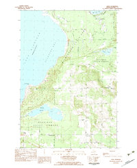
1982 Map of Bliss
USGS Topo · Published 1983About this map
Wilderness State Park and the expansive Mackinaw State Forest dominate this northern tip of the Lower Peninsula, where the waters of Lake Michigan meet a complex shoreline of bays and points. The interior is defined by low-lying wetlands and small inland waters like Wycamp Lake and O'Neal Lake. Human settlement is concentrated at crossroads like Bliss, where the Bliss Ch and Township Cem serve the local community. Further south, named junctions such as Wesbters Corners and Canby Corners mark the transition from protected forest land to rural homesteads. The presence of the Bliss Lookout Tower on a high ridge near Billiau Hill underscores the region's managed timber and fire-watch history. This provisional survey captures the late 20th-century landscape of Emmet County, balancing recreational coastline features like Sturgeon Bay Point with the quiet, inland life of small farming corners.
Find a feature on this map
38 named features on this map. Tap any name to fly to it.
Don’t see what you’re looking for? This feature index may not catch every label — zoom into the map to look around manually.
Map Details
Editions of this 1982 Bliss Map
This is the sole edition of this map. No revisions or reprints were ever made.
Other maps of this area

1955 · Cheboygan
USGS Topo · 1:250,000

1958 · Cheboygan
USGS Topo · 1:250,000

1958 · Cross Village
USGS Topo · 1:62,500

1958 · Pellston
USGS Topo · 1:62,500

1964 · Big Stone Bay
USGS Topo · 1:24,000
1964 · McGulpin Point
USGS Topo · 1:24,000
1982 · Levering
USGS Topo · 1:25,000

1982 · Pellston
USGS Topo · 1:25,000
1982 · Good Hart
USGS Topo · 1:25,000
1982 · Waugoshance Island
USGS Topo · 1:25,000