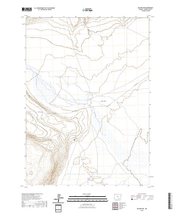
2023 Map of Blitzen NW
USGS Topo · Published 2023About this map
Catlow Valley defines this portion of the high desert, where water and topography shape a quiet landscape of seasonal wetlands and drainage systems. The basin is traversed by the winding course of Rock Creek, which feeds into a complex network of marshy terrain before connecting with the northward-draining Guano Slough. Human presence is sparse, anchored by the Rock Creek Cem located just west of the main creek bed. Modern infrastructure is limited to the unpaved Rock Creek Ln, which cuts diagonally across the valley floor. The map provides a detailed view of the Public Land Survey System grid, tracing township lines like t33s r30e and t34s r30e across the open flats and low-lying elevations of southern Harney County.
Find a feature on this map
11 named features on this map. Tap any name to fly to it.
Don’t see what you’re looking for? This feature index may not catch every label — zoom into the map to look around manually.
Map Details
Editions of this 2023 Blitzen NW Map
This is the sole edition of this map. No revisions or reprints were ever made.
Other maps of this area

1955 · Adel
USGS Topo · 1:250,000

1957 · Adel
USGS Topo · 1:250,000

1958 · Adel
USGS Topo · 1:250,000

1962 · Adel
USGS Topo · 1:250,000

1971 · Duhaime Flat East
USGS Topo · 1:24,000

1971 · Blitzen
USGS Topo · 1:24,000

1971 · Butler Hill
USGS Topo · 1:24,000
1971 · Guano Reservoir
USGS Topo · 1:24,000
1971 · Duhaime Flat West
USGS Topo · 1:24,000
1971 · Blitzen SW
USGS Topo · 1:24,000