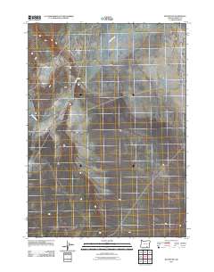
2011 Map of Blitzen SW
USGS Topo · Published 2011About this map
Berdugo stands as the primary namesake settlement in this high desert landscape of Harney County, Oregon. The topography is defined by the ephemeral passage of Guano Slough, which meanders from the northwest down toward the south-central portion of the quadrangle. This 2011 survey illustrates a sparse ranching or outpost environment where infrastructure is limited to a handful of local roads and unimproved trails that cross the arid basins. The presence of Berdugo suggests a localized center of activity in a region characterized by wide open spaces and the subtle drainage patterns of the northern Great Basin, where water features like the slough are central to the geography of the land.
Find a feature on this map
2 named features on this map. Tap any name to fly to it.
Don’t see what you’re looking for? This feature index may not catch every label — zoom into the map to look around manually.
Map Details
Editions of this 2011 Blitzen SW Map
This is the sole edition of this map. No revisions or reprints were ever made.
Other maps of this area

1955 · Adel
USGS Topo · 1:250,000

1957 · Adel
USGS Topo · 1:250,000

1958 · Adel
USGS Topo · 1:250,000

1962 · Adel
USGS Topo · 1:250,000

1971 · Fish Fin Rim
USGS Topo · 1:24,000

1971 · Beatys Butte
USGS Topo · 1:24,000

1971 · Blitzen
USGS Topo · 1:24,000

1971 · Butler Hill
USGS Topo · 1:24,000
1971 · Guano Reservoir
USGS Topo · 1:24,000
1971 · Coyote Gap
USGS Topo · 1:24,000