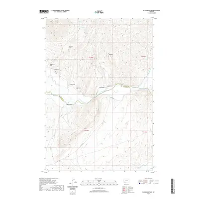
2020 Map of Block Mountain
USGS Topo · Published 2020About this map
The Big Hole River serves as the primary drainage and boundary between Madison and Beaverhead counties, cutting through a landscape defined by sharp elevation changes and early ranching infrastructure. Near the riverbanks, the Sodak Mill and several irrigation works like the Fred Bryant Ditch and Coconougher Ditch illustrate the region's historical reliance on water management for agriculture and industry. The terrain rises steeply from the river flats toward prominent landmarks such as Bell Peak and Block Mtn, while complex drainage features like Stevens Slough and Albers Slough occupy the lower basins.
Find a feature on this map
29 named features on this map. Tap any name to fly to it.
Don’t see what you’re looking for? This feature index may not catch every label — zoom into the map to look around manually.
Map Details
Editions of this 2020 Block Mountain Map
This is the sole edition of this map. No revisions or reprints were ever made.
Other maps of this area

1893 · Dillon
USGS Topo · 1:250,000

1955 · Dillon
USGS Topo · 1:250,000

1957 · Dillon
USGS Topo · 1:250,000

1958 · Dillon
USGS Topo · 1:250,000

1960 · Glen
USGS Topo · 1:24,000

1960 · Block Mountain
USGS Topo · 1:24,000

1960 · Twin Bridges
USGS Topo · 1:62,500

1961 · Glen SE
USGS Topo · 1:24,000

1961 · Earls Gulch
USGS Topo · 1:24,000

1961 · Nez Perce Hollow
USGS Topo · 1:24,000