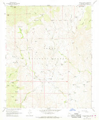
1967 Map of Bloody Basin
USGS Topo · Published 1968About this map
The high desert topography of Tonto National Forest is defined here by the winding drainages and volcanic remnants of the Bloody Basin. This mid-century survey documents a remote landscape where water sources like Soda Springs, Tear Spring, and Peet Spring dictated the placement of early cattle operations. Notable family and working outfits include the TT Ranch, LX Bar Ranch, and Dugan Ranch, alongside simple shelters such as the Tangle Creek Cabin. The map captures an era when transportation across this complex terrain relied heavily on a network of established jeep trails connecting remote livestock tanks like Javelina Tank and Turtle Tank. Evidence of early resource extraction is preserved at the Marble Mine near Soda Spring No 1, while landmarks like Turret Peak and Ruin Point provided essential navigation points for ranchers and surveyors working the deep canyons of the Mustang Hills.
Find a feature on this map
89 named features on this map. Tap any name to fly to it.
Don’t see what you’re looking for? This feature index may not catch every label — zoom into the map to look around manually.
Map Details
Editions of this 1967 Bloody Basin Map
2 editions found
Other maps of this area

1887 · Verde
USGS Topo · 1:250,000

1892 · Verde
USGS Topo · 1:250,000

1929 · Turret Peak
USGS Topo · 1:125,000

1933 · Turret Peak
USGS Topo · 1:125,000

1954 · Holbrook
USGS Topo · 1:250,000

1957 · Holbrook
USGS Topo · 1:250,000

1958 · Holbrook
USGS Topo · 1:250,000

1960 · Holbrook
USGS Topo · 1:250,000
1967 · Brooklyn Peak
USGS Topo · 1:24,000
1967 · Chalk Mountain
USGS Topo · 1:24,000