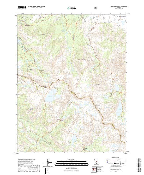
2021 Map of Bloody Mountain
USGS Topo · Published 2021About this map
Mammoth Lakes serves as the northern anchor of this high-altitude landscape, where the crest of the Sierra Nevada forms a natural boundary between Inyo National Forest and Sierra National Forest. The 2021 topography reveals a complex network of alpine basins, featuring prominent peaks like Bloody Mtn and Laurel Mtn. This area is characterized by a high density of glacial lakes, including the expansive Duck Lake, Sherwin Lakes, and Lake Virginia, all linked by an intricate system of backcountry routes such as the Pacific Crest National Scenic Trl and the Duck Pass Trl. Historically significant markers like Gibbs Cem near Panorama Dome sit adjacent to the recreational infrastructure of the Mammoth Lakes Pack Station Trl. The map also captures the descent into Cascade Valley and the remote meadows of Tully Hole, illustrating the transition from volcanic domes to steep granite escarpments.
Find a feature on this map
80 named features on this map. Tap any name to fly to it.
Don’t see what you’re looking for? This feature index may not catch every label — zoom into the map to look around manually.
Map Details
Editions of this 2021 Bloody Mountain Map
This is the sole edition of this map. No revisions or reprints were ever made.
Other maps of this area

1901 · Mt. Lyell
USGS Topo · 1:125,000

1904 · Kaiser
USGS Topo · 1:125,000

1912 · Mt. Goddard
USGS Topo · 1:125,000

1914 · Mt. Morrison
USGS Topo · 1:125,000

1947 · Mariposa
USGS Topo · 1:250,000

1948 · Mariposa
USGS Topo · 1:250,000

1953 · Mt. Morrison
USGS Topo · 1:62,500

1953 · Mt Abbot
USGS Topo · 1:62,500

1953 · Devils Postpile
USGS Topo · 1:62,500

1953 · Kaiser Peak
USGS Topo · 1:62,500