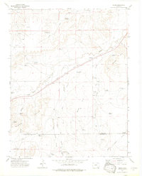
1972 Map of Bloom
USGS Topo · Published 1976About this map
Atchison Topeka and Santa Fe railroad tracks slice diagonally through this high plains landscape, anchoring the small settlements of Bloom and Mindeman. The topography is defined by the Bloom Hills and Merker Hills, where a sophisticated network of water management features—including Lambing Camp Reservoir, Government Reservoir, and Swisher Reservoir—sustains the arid environment. Numerous family-named landmarks like Baski Windmill, Hedgecock Windmill, and Cochran Reservoir suggest a lineage of ranching and livestock operations tied to the drainage of Timpas Creek. The presence of a small Cem near Bloom and several Landing Strips further north highlights the intersection of early pioneer settlement and mid-century utility. This map captures a specific era of Colorado history where the cattle economy, rail transportation, and the boundary between Otero and Las Animas Counties converged.
Find a feature on this map
45 named features on this map. Tap any name to fly to it.
Don’t see what you’re looking for? This feature index may not catch every label — zoom into the map to look around manually.
Map Details
Editions of this 1972 Bloom Map
3 editions found
Other maps of this area

1891 · Timpas
USGS Topo · 1:125,000

1891 · Apishapa
USGS Topo · 1:125,000

1893 · Apishapa
USGS Topo · 1:125,000

1894 · Timpas
USGS Topo · 1:125,000

1897 · Apishapa
USGS Topo · 1:125,000

1954 · Trinidad
USGS Topo · 1:250,000

1955 · La Junta
USGS Topo · 1:250,000

1955 · Trinidad
USGS Topo · 1:250,000

1958 · La Junta
USGS Topo · 1:250,000

1958 · Trinidad
USGS Topo · 1:250,000