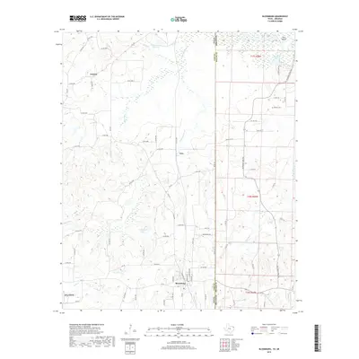
2019 Map of Bloomburg
USGS Topo · Published 2019About this map
Bloomburg and Domino anchor this survey of the northeast Texas borderlands, where the landscape is defined by the complex hydrology of the Sulphur River and its numerous tributaries. The map details a transition from the elevated terrain near Atlanta to the low-lying wetlands and sloughs of the river basin. Key water features like Porterfield Lake and Cypress Slough highlight the riparian character of Cass County, while the eastern edge follows the Texas Arkansas state line, marked in part by State Line Creek. The road network, including FM 3129 and FM 251, connects these small communities and agricultural lands. One notable genealogical landmark is Walters Cemetery, situated near Smith Lake and the Ford Islands. The presence of the West Fork Kelly Bayou in the southeast corner indicates the diverse drainage systems that converge in this corner of the state.
Find a feature on this map
80 named features on this map. Tap any name to fly to it.
Don’t see what you’re looking for? This feature index may not catch every label — zoom into the map to look around manually.
Map Details
Editions of this 2019 Bloomburg Map
This is the sole edition of this map. No revisions or reprints were ever made.
Other maps of this area

1907 · Atlanta
USGS Topo · 1:62,500

1909 · Texarkana
USGS Topo · 1:62,500

1910 · Atlanta
USGS Topo · 1:62,500

1952 · Doddridge NW
USGS Topo · 1:24,000

1952 · Doddridge
USGS Topo · 1:24,000

1952 · Fouke
USGS Topo · 1:24,000

1953 · Texarkana
USGS Topo · 1:250,000

1953 · El Dorado
USGS Topo · 1:250,000

1954 · Domino
USGS Topo · 1:24,000

1954 · Lake Texarkana
USGS Topo · 1:24,000