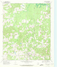
1969 Map of Bloomburg
USGS Topo · Published 1972About this map
Bloomburg and the small settlement of Cass serve as the primary hubs in this late 1960s survey of the Texas-Arkansas borderlands. The landscape is defined by the winding course of the Sulphur River and its associated Days Creek Islands in the northeast, while the Kansas City Southern railroad cuts a straight north-south path through the center. This region is a study in rural community infrastructure, as evidenced by a network of local churches including Golden Gate Ch, Center Point Ch, Sand Hill Ch, and Salem Ch. The presence of the State Line Road and the dividing line between Cass Co and Miller Co highlights the legal and social boundaries of the era. Genealogists may find value in the specific locations of the Macedonia Cem and Walters Cem, which are situated amidst the drainages of Cypress Creek and Turkey Creek.
Find a feature on this map
29 named features on this map. Tap any name to fly to it.
Don’t see what you’re looking for? This feature index may not catch every label — zoom into the map to look around manually.
Map Details
Editions of this 1969 Bloomburg Map
This is the sole edition of this map. No revisions or reprints were ever made.
Other maps of this area

1907 · Atlanta
USGS Topo · 1:62,500

1909 · Texarkana
USGS Topo · 1:62,500

1910 · Atlanta
USGS Topo · 1:62,500

1952 · Doddridge NW
USGS Topo · 1:24,000

1952 · Doddridge
USGS Topo · 1:24,000

1952 · Fouke
USGS Topo · 1:24,000

1953 · Texarkana
USGS Topo · 1:250,000

1953 · El Dorado
USGS Topo · 1:250,000

1954 · Domino
USGS Topo · 1:24,000

1954 · Lake Texarkana
USGS Topo · 1:24,000