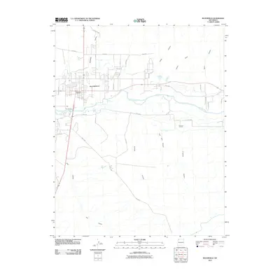
2010 Map of Bloomfield
USGS Topo · Published 2010About this map
Bloomfield serves as the focal point of this Northwest New Mexico landscape, situated at the intersection of the San Juan River and a network of arterial roads. The settlement's infrastructure is anchored by the Bloomfield Post Office and a dense residential grid that spreads north toward Delaware. To the south and east, the terrain becomes increasingly dissected by a series of significant drainage features, including the broad Kutz Canyon and several smaller systems such as Sullivan Canyon and Tom Gale Canyon. The presence of the Citizens Ditch running parallel to the river reflects the critical role of water management in this arid environment, supporting the community and local land use. Further east, the Hammond Cemetery provides a specific point of interest for genealogists tracing family histories in this part of San Juan County, while numerous canyons like Slane Canyon and Potter Canyon define the high ground above the river valley.
Find a feature on this map
34 named features on this map. Tap any name to fly to it.
Don’t see what you’re looking for? This feature index may not catch every label — zoom into the map to look around manually.
Map Details
Editions of this 2010 Bloomfield Map
This is the sole edition of this map. No revisions or reprints were ever made.
Other maps of this area

1889 · Largo
USGS Topo · 1:250,000

1889 · Chaco
USGS Topo · 1:250,000

1892 · Chaco
USGS Topo · 1:250,000

1895 · Largo
USGS Topo · 1:250,000

1954 · Shiprock
USGS Topo · 1:250,000

1954 · Aztec
USGS Topo · 1:250,000

1958 · Shiprock
USGS Topo · 1:250,000

1958 · Aztec
USGS Topo · 1:250,000

1959 · Shiprock
USGS Topo · 1:250,000

1959 · Aztec
USGS Topo · 1:62,500