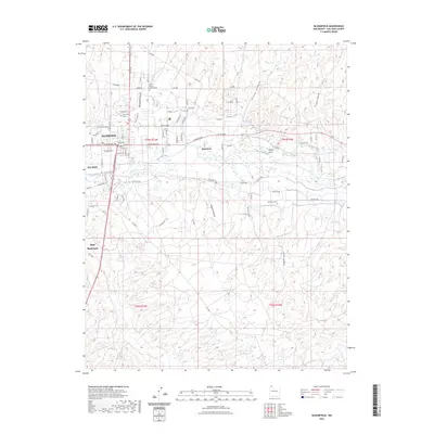
2023 Map of Bloomfield
USGS Topo · Published 2023About this map
The San Juan River corridor serves as the lifeblood for this high-desert community, where early 21st-century irrigation infrastructure like Citizens Ditch supports the valley settlements. The city of Bloomfield anchors the northwest corner of the map, characterized by a grid of streets such as W Broadway Ave and E Broadway Ave that reflect its role as a regional crossroads. Beyond the developed areas of Lee Acres and West Hammond, the landscape is defined by complex drainage systems and erosion patterns visible in Bloomfield Canyon and Valdez Draw. Genealogists will find the locations of multiple burial grounds, including the Saint Marys Catholic Cem, Bloomfield Cem, and the more isolated Hammond Cem near the southern banks of the river, providing vital clues for family history research in San Juan County.
Find a feature on this map
83 named features on this map. Tap any name to fly to it.
Don’t see what you’re looking for? This feature index may not catch every label — zoom into the map to look around manually.
Map Details
Editions of this 2023 Bloomfield Map
This is the sole edition of this map. No revisions or reprints were ever made.
Other maps of this area

1889 · Largo
USGS Topo · 1:250,000

1889 · Chaco
USGS Topo · 1:250,000

1892 · Chaco
USGS Topo · 1:250,000

1895 · Largo
USGS Topo · 1:250,000

1954 · Shiprock
USGS Topo · 1:250,000

1954 · Aztec
USGS Topo · 1:250,000

1958 · Shiprock
USGS Topo · 1:250,000

1958 · Aztec
USGS Topo · 1:250,000

1959 · Shiprock
USGS Topo · 1:250,000

1959 · Aztec
USGS Topo · 1:62,500