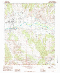
1985 Map of Bloomfield
USGS Topo · Published 1985About this map
Bloomfield serves as the focal point of this mid-1980s landscape, positioned along the northern banks of the San Juan River. The terrain is defined by a sophisticated network of water management systems designed to reclaim the arid desert, including the Citizens Ditch and Hammond Ditch. To the south, the massive Navajo Indian Irrigation Project Main Canal cuts through the high ground, illustrating the scale of federal water engineering in the San Juan Basin. The region’s economic character is visible through the extensive Gas Field and the Refinery located just south of town. Beyond the developed corridors, the map reveals a complex topography of erosional features like Kutz Canyon, Sullivan Canyon, and Tom Gale Canyon, which descend toward the river valley from the surrounding plateaus.
Find a feature on this map
26 named features on this map. Tap any name to fly to it.
Don’t see what you’re looking for? This feature index may not catch every label — zoom into the map to look around manually.
Map Details
Editions of this 1985 Bloomfield Map
This is the sole edition of this map. No revisions or reprints were ever made.
Other maps of this area

1889 · Largo
USGS Topo · 1:250,000

1889 · Chaco
USGS Topo · 1:250,000

1892 · Chaco
USGS Topo · 1:250,000

1895 · Largo
USGS Topo · 1:250,000

1954 · Shiprock
USGS Topo · 1:250,000

1954 · Aztec
USGS Topo · 1:250,000

1958 · Shiprock
USGS Topo · 1:250,000

1958 · Aztec
USGS Topo · 1:250,000

1959 · Shiprock
USGS Topo · 1:250,000

1959 · Aztec
USGS Topo · 1:62,500