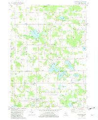
1981 Map of Bloomingdale
USGS Topo · Published 1982About this map
Bloomingdale and Berlamont anchor this survey of the northern Van Buren County border, a landscape defined by an extensive network of kettle lakes and agricultural drainage. The transition between the Allegan Co Van Buren Co line is marked by a concentration of small family and community burial grounds, including Indian Cem, Lindsley Cem, and Rowe Cem. The region's watery geography is particularly dense here, featuring the interconnected basins of Eagle Lake, Duck Lake, and Muskrat Lake, while Swan Creek meanders through the northwest corner near Chicora.
Find a feature on this map
70 named features on this map. Tap any name to fly to it.
Don’t see what you’re looking for? This feature index may not catch every label — zoom into the map to look around manually.
Map Details
Editions of this 1981 Bloomingdale Map
This is the sole edition of this map. No revisions or reprints were ever made.
Other maps of this area

1927 · Bangor
USGS Topo · 1:62,500

1928 · Fennville
USGS Topo · 1:62,500

1931 · Fennville
USGS Topo · 1:62,500

1931 · Bangor
USGS Topo · 1:62,500

1943 · Bangor
USGS Topo · 1:62,500

1946 · Gobles
USGS Topo · 1:62,500

1948 · Gobles
USGS Topo · 1:62,500

1949 · Gobles
USGS Topo · 1:62,500

1958 · Allegan
USGS Topo · 1:62,500

1958 · Racine
USGS Topo · 1:250,000