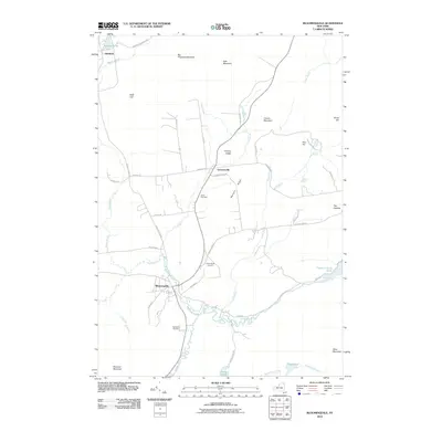
2010 Map of Bloomingdale
USGS Topo · Published 2010About this map
Bloomingdale and Vermontville anchor this 2010 topographic record of the Adirondacks, where the Saranac River winds through the southern reaches before curving north toward Franklin Falls Pond. The landscape is defined by its significant relief, featuring the prominent peaks of Kate Mountain, Big Haystack Mountain, and the rocky outcropping known as The Cobbles. For local historians and genealogists, the map provides precise locations for three local burying grounds: Union Cemetery, Saint Pauls Cemetery, and Brookside Cemetery. The network of backroads like Fletcher Farm Rd and Oregon Plains Rd connect scattered homesteads and high terrain such as Norman Ridge, showing how the modern Adirondack Park infrastructure integrates with the natural topography of ridges and brooks.
Find a feature on this map
48 named features on this map. Tap any name to fly to it.
Don’t see what you’re looking for? This feature index may not catch every label — zoom into the map to look around manually.
Map Details
Editions of this 2010 Bloomingdale Map
This is the sole edition of this map. No revisions or reprints were ever made.
Other maps of this area

1896 · Lake Placid
USGS Topo · 1:62,500

1898 · Lake Placid
USGS Topo · 1:62,500

1902 · Saranac
USGS Topo · 1:62,500

1904 · Saranac
USGS Topo · 1:62,500

1906 · Loon Lake
USGS Topo · 1:62,500

1908 · Loon Lake
USGS Topo · 1:62,500

1911 · Lyon Mountain
USGS Topo · 1:62,500

1913 · Lyon Mountain
USGS Topo · 1:62,500

1931 · Lyon Mountain
USGS Topo · 1:62,500

1948 · Ogdensburg
USGS Topo · 1:250,000