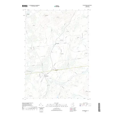
2019 Map of Bloomingdale
USGS Topo · Published 2019About this map
Bloomingdale and Vermontville serve as central points in this landscape where the Franklin and Essex county lines meet. The terrain is defined by a series of prominent peaks and ledges, including Kate Mtn, Big Haystack Mtn, and the high overlooks of Shenes Ledge. Family history and local heritage are anchored by Brookside Cem, Saint Pauls Cem, and Union Cem, which lie scattered along the rural road network. The Saranac River flows through the southern portion of the area, complemented by numerous water bodies like Moose Pond, Grass Pond, and Oregon Pond. Significant portions of the land are managed as part of the Adirondack Park Preserve, protecting the natural character of the drainage basins for Negro Brook, Alder Brook, and Cold Brook.
Find a feature on this map
55 named features on this map. Tap any name to fly to it.
Don’t see what you’re looking for? This feature index may not catch every label — zoom into the map to look around manually.
Map Details
Editions of this 2019 Bloomingdale Map
This is the sole edition of this map. No revisions or reprints were ever made.
Other maps of this area

1896 · Lake Placid
USGS Topo · 1:62,500

1898 · Lake Placid
USGS Topo · 1:62,500

1902 · Saranac
USGS Topo · 1:62,500

1904 · Saranac
USGS Topo · 1:62,500

1906 · Loon Lake
USGS Topo · 1:62,500

1908 · Loon Lake
USGS Topo · 1:62,500

1911 · Lyon Mountain
USGS Topo · 1:62,500

1913 · Lyon Mountain
USGS Topo · 1:62,500

1931 · Lyon Mountain
USGS Topo · 1:62,500

1948 · Ogdensburg
USGS Topo · 1:250,000