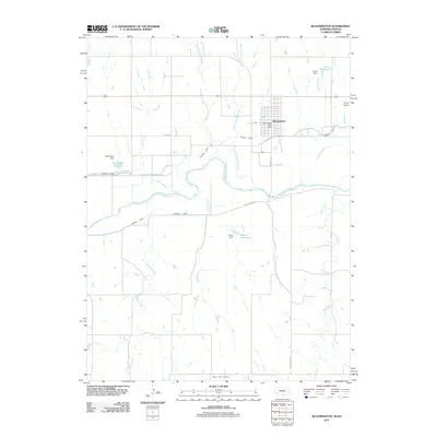
2011 Map of Bloomington
USGS Topo · Published 2011About this map
The Republican River valley defines this section of Franklin County, where irrigation and water management are central to the landscape's character. Significant water infrastructure is visible through the Franklin Canal and Naponee Canal, which parallel the river's course to support local agriculture. The village of Bloomington serves as the primary settlement, featuring the Bloomington Post Office and a grid of streets centered on Central Ave. Numerous private dams and reservoirs, such as James Reservoir, Rasmussen Reservoir, and Kahrs Reservoir, are scattered across the terrain, indicating a highly managed hydrological environment. Beyond the valley, the topography is carved by a network of drainages including Big Cottonwood Creek, Lochile Creek, and Rebecca Creek, while the Mount Olive Cemetery stands as a quiet marker of the area's local history and lineage.
Find a feature on this map
23 named features on this map. Tap any name to fly to it.
Don’t see what you’re looking for? This feature index may not catch every label — zoom into the map to look around manually.
Map Details
Editions of this 2011 Bloomington Map
This is the sole edition of this map. No revisions or reprints were ever made.
Other maps of this area

1893 · Smith Center
USGS Topo · 1:125,000

1893 · Phillipsburg
USGS Topo · 1:125,000

1896 · Holdrege
USGS Topo · 1:125,000

1897 · Red Cloud
USGS Topo · 1:125,000

1955 · Grand Island
USGS Topo · 1:250,000

1955 · Beloit
USGS Topo · 1:250,000

1957 · Grand Island
USGS Topo · 1:250,000

1958 · Grand Island
USGS Topo · 1:250,000

1959 · Beloit
USGS Topo · 1:250,000

1973 · Kensington NE
USGS Topo · 1:24,000