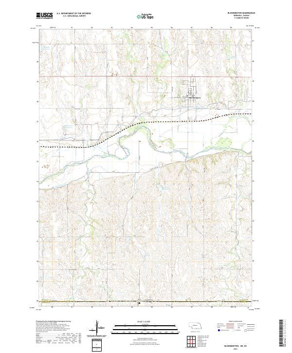
2021 Map of Bloomington
USGS Topo · Published 2021About this map
Bloomington sits just north of the Republican River in Franklin County, where an extensive network of irrigation and water management infrastructure defines the landscape. The Franklin Canal and Naponee Canal trace the elevation contours alongside the river valley, supporting the agricultural vitality of the region. This 2021 survey reveals a territory marked by numerous private and municipal impoundments, including Kahrs Reservoir, James Reservoir, and Saathoff Reservoir, illustrating the critical role of water storage in this section of the Great Plains. The southern edge of the map follows the Nebraska-Kansas state line, passing through rural farm tracts connected by a strictly gridded road system. Genealogists and local historians can locate Mount Olive Cem south of the river, while recreation and transit are represented by the Republican River Trl and major local arteries such as Turkey Creek Rd.
Find a feature on this map
50 named features on this map. Tap any name to fly to it.
Don’t see what you’re looking for? This feature index may not catch every label — zoom into the map to look around manually.
Map Details
Editions of this 2021 Bloomington Map
This is the sole edition of this map. No revisions or reprints were ever made.
Other maps of this area

1893 · Smith Center
USGS Topo · 1:125,000

1893 · Phillipsburg
USGS Topo · 1:125,000

1896 · Holdrege
USGS Topo · 1:125,000

1897 · Red Cloud
USGS Topo · 1:125,000

1955 · Grand Island
USGS Topo · 1:250,000

1955 · Beloit
USGS Topo · 1:250,000

1957 · Grand Island
USGS Topo · 1:250,000

1958 · Grand Island
USGS Topo · 1:250,000

1959 · Beloit
USGS Topo · 1:250,000

1973 · Kensington NE
USGS Topo · 1:24,000