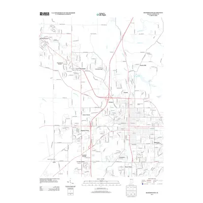
2013 Map of Bloomington
USGS Topo · Published 2013About this map
Ellettsville and the western reaches of Bloomington define this 2013 survey of Monroe County. The map documents the extensive residential development of neighborhoods like West Brook Downs, Forest Park Heights, and Highland Village as they expanded toward the Monroe County Airport. The urban core is anchored by the Indiana University Stadium, while water resources like the Griffy Reservoir, University Lake, and Weimer Lake contrast with the dense network of numbered streets and thoroughfares such as W Kirkwood Ave and W Tapp Rd.
Find a feature on this map
97 named features on this map. Tap any name to fly to it.
Don’t see what you’re looking for? This feature index may not catch every label — zoom into the map to look around manually.
Map Details
Editions of this 2013 Bloomington Map
This is the sole edition of this map. No revisions or reprints were ever made.
Other maps of this area

1908 · Bloomington
USGS Topo · 1:48,000

1910 · Bloomington
USGS Topo · 1:62,500

1942 · Franklin
USGS Topo · 1:125,000

1947 · Allens Creek
USGS Topo · 1:24,000

1947 · Unionville
USGS Topo · 1:24,000

1947 · Gosport
USGS Topo · 1:24,000

1948 · Hindustan
USGS Topo · 1:24,000

1950 · Gosport
USGS Topo · 1:24,000

1953 · Indianapolis
USGS Topo · 1:250,000

1956 · Indianapolis
USGS Topo · 1:250,000