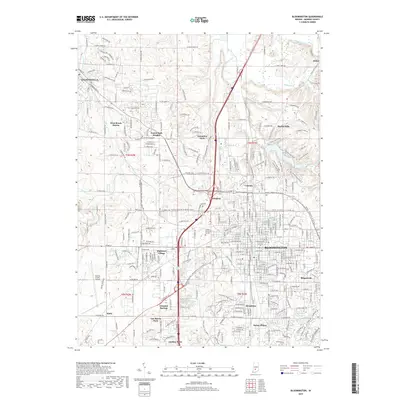
2019 Map of Bloomington
USGS Topo · Published 2019About this map
Bloomington serves as the focal point of this 2019 survey, revealing a landscape defined by collegiate growth and mid-century suburban expansion. The map detail extends from the historic core and the Rose Hill Cem westward to the Monroe County Airport, capturing the transition from dense urban street grids to sprawling residential developments like Highland Village and West Brook Downs. The northern reaches are shaped by the winding course of Beanblossom Creek and the smaller tributaries of Jacks Defeat Cr, providing a clear view of how the local topography influenced early settlement patterns in Ellettsville and Dolan.
Find a feature on this map
171 named features on this map. Tap any name to fly to it.
Don’t see what you’re looking for? This feature index may not catch every label — zoom into the map to look around manually.
Map Details
Editions of this 2019 Bloomington Map
This is the sole edition of this map. No revisions or reprints were ever made.
Other maps of this area

1908 · Bloomington
USGS Topo · 1:48,000

1910 · Bloomington
USGS Topo · 1:62,500

1942 · Franklin
USGS Topo · 1:125,000

1947 · Allens Creek
USGS Topo · 1:24,000

1947 · Unionville
USGS Topo · 1:24,000

1947 · Gosport
USGS Topo · 1:24,000

1948 · Hindustan
USGS Topo · 1:24,000

1950 · Gosport
USGS Topo · 1:24,000

1953 · Indianapolis
USGS Topo · 1:250,000

1956 · Indianapolis
USGS Topo · 1:250,000