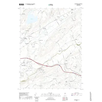
2019 Map of Bloomsbury
USGS Topo · Published 2019About this map
Bloomsbury and its surrounding townships define this corridor of the New Jersey highlands, where the Musconetcong River and Pohatcong Creek carve parallel valleys through the landscape. The geography is dominated by a series of southwest-to-northeast ridges including Pohatcong Mtn, Scotts Mtn, and Musconetcong Mtn. This alignment has historically dictated transport and settlement, from the early milling sites at Allens Mills and Kennedy Mills to the modern path of the Norfolk Southern railroad.
Find a feature on this map
146 named features on this map. Tap any name to fly to it.
Don’t see what you’re looking for? This feature index may not catch every label — zoom into the map to look around manually.
Map Details
Editions of this 2019 Bloomsbury Map
This is the sole edition of this map. No revisions or reprints were ever made.
Other maps of this area

1888 · Hackettstown
USGS Topo · 1:62,500

1890 · Easton
USGS Topo · 1:62,500

1890 · High Bridge
USGS Topo · 1:62,500

1891 · Easton
USGS Topo · 1:62,500

1891 · Delaware Water Gap
USGS Topo · 1:62,500

1893 · Delaware Water Gap
USGS Topo · 1:62,500

1894 · Hackettstown
USGS Topo · 1:62,500

1898 · Hackettstown
USGS Topo · 1:62,500

1898 · High Bridge
USGS Topo · 1:62,500

1900 · Raritan
USGS Topo · 1:125,000