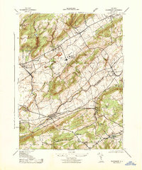
1943 Map of Bloomsbury
USGS Topo · Published 1943About this map
Industrial and rural life converge in this 1942 survey of the Musconetcong Valley, where the heavy industry of the Edison Portland Cement Co and West Portal Mines (Magnetite) contrast with the small agrarian hamlets of Asbury and Stewartsville. The landscape is defined by the ridge lines of Scotts Mountain and Pohatcong Mountain, forcing a dense corridor of transportation through the valley floor.
Find a feature on this map
48 named features on this map. Tap any name to fly to it.
Don’t see what you’re looking for? This feature index may not catch every label — zoom into the map to look around manually.
Map Details
Editions of this 1943 Bloomsbury Map
This is the sole edition of this map. No revisions or reprints were ever made.
Other maps of this area

1888 · Hackettstown
USGS Topo · 1:62,500

1890 · Easton
USGS Topo · 1:62,500

1890 · High Bridge
USGS Topo · 1:62,500

1891 · Easton
USGS Topo · 1:62,500

1891 · Delaware Water Gap
USGS Topo · 1:62,500

1893 · Delaware Water Gap
USGS Topo · 1:62,500

1894 · Hackettstown
USGS Topo · 1:62,500

1898 · Hackettstown
USGS Topo · 1:62,500

1898 · High Bridge
USGS Topo · 1:62,500

1900 · Raritan
USGS Topo · 1:125,000