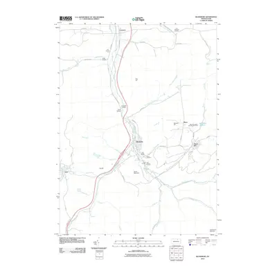
2010 Map of Blossburg
USGS Topo · Published 2010About this map
The Tioga River carves a deep valley through this part of Tioga County, centering on the historic coal and iron hub of Blossburg. This 2010 survey shows the modern footprint of settlements like Covington, Arnot, and Morris Run, while preserving the locations of numerous historic burial grounds such as Saint Marys Cemetery, Arbon Cemetery, and the Frost Settlement Cemetery. The industrial legacy of the region is evident near the eastern edge of the map, where the Morris Run Mine Dam Number Three and Morris Run Reservoir sit among the ridges. High points like Pine Hill and South Mountain overlook a complex network of waterways, including Canoe Camp Creek and Johnson Creek, which define the rugged geography of the Tioga Valley. Local genealogists will find value in the precise placement of family-named landmarks and the concentrated group of cemeteries located just south of the Blossburg town center.
Find a feature on this map
63 named features on this map. Tap any name to fly to it.
Don’t see what you’re looking for? This feature index may not catch every label — zoom into the map to look around manually.
Map Details
Editions of this 2010 Blossburg Map
This is the sole edition of this map. No revisions or reprints were ever made.
Other maps of this area

1900 · Tioga
USGS Topo · 1:62,500

1902 · Tioga
USGS Topo · 1:62,500

1925 · Blossburg
USGS Topo · 1:62,500

1927 · Blossburg
USGS Topo · 1:62,500

1931 · Troy
USGS Topo · 1:48,000

1938 · Troy
USGS Topo · 1:62,500

1942 · Canton
USGS Topo · 1:62,500

1944 · Blossburg
USGS Topo · 1:62,500

1944 · Canton
USGS Topo · 1:62,500

1953 · Roseville
USGS Topo · 1:24,000