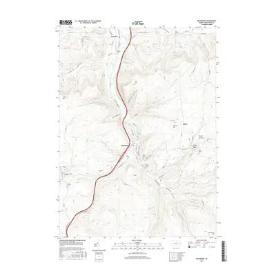
2016 Map of Blossburg
USGS Topo · Published 2016About this map
The Tioga River carves through the heart of this Tioga County region, anchoring the industrial and residential development of Blossburg and Covington. By the early 21st century, the landscape reflects a complex history of settlement and resource extraction, with the valley floor dominated by the Appalachian Thruway and the winding river. To the east, the community of Morris Run sits near the Morris Run Reservoir, surrounded by several religious and civic burial grounds including the Morris Run - Lutheran Community Cem and Saint Josephs Cem.
Find a feature on this map
93 named features on this map. Tap any name to fly to it.
Don’t see what you’re looking for? This feature index may not catch every label — zoom into the map to look around manually.
Map Details
Editions of this 2016 Blossburg Map
This is the sole edition of this map. No revisions or reprints were ever made.
Other maps of this area

1900 · Tioga
USGS Topo · 1:62,500

1902 · Tioga
USGS Topo · 1:62,500

1925 · Blossburg
USGS Topo · 1:62,500

1927 · Blossburg
USGS Topo · 1:62,500

1931 · Troy
USGS Topo · 1:48,000

1938 · Troy
USGS Topo · 1:62,500

1942 · Canton
USGS Topo · 1:62,500

1944 · Blossburg
USGS Topo · 1:62,500

1944 · Canton
USGS Topo · 1:62,500

1953 · Roseville
USGS Topo · 1:24,000