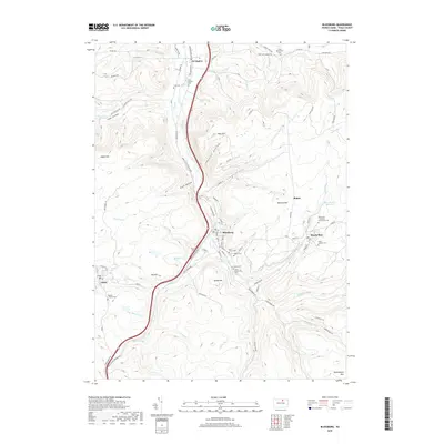
2019 Map of Blossburg
USGS Topo · Published 2019About this map
Blossburg and the surrounding high ground of Tioga County are defined by a complex network of narrow valleys and ridges that once fueled the region's coal and timber industries. The Tioga River flows north toward Covington, flanked by the Appalachian Throughway and significant peaks such as South Mtn and Pine Hill. This modern survey traces the enduring footprint of industrial-era settlements like Arnot and Morris Run, where small residential clusters remain situated along the steep slopes of Pig Hill and Barneys Hill.
Find a feature on this map
100 named features on this map. Tap any name to fly to it.
Don’t see what you’re looking for? This feature index may not catch every label — zoom into the map to look around manually.
Map Details
Editions of this 2019 Blossburg Map
This is the sole edition of this map. No revisions or reprints were ever made.
Other maps of this area

1900 · Tioga
USGS Topo · 1:62,500

1902 · Tioga
USGS Topo · 1:62,500

1925 · Blossburg
USGS Topo · 1:62,500

1927 · Blossburg
USGS Topo · 1:62,500

1931 · Troy
USGS Topo · 1:48,000

1938 · Troy
USGS Topo · 1:62,500

1942 · Canton
USGS Topo · 1:62,500

1944 · Blossburg
USGS Topo · 1:62,500

1944 · Canton
USGS Topo · 1:62,500

1953 · Roseville
USGS Topo · 1:24,000